DAMAGE ASSESSMENTS
Landslips / Wind / Fire / Flood
AERIAL ASSESSMENTS
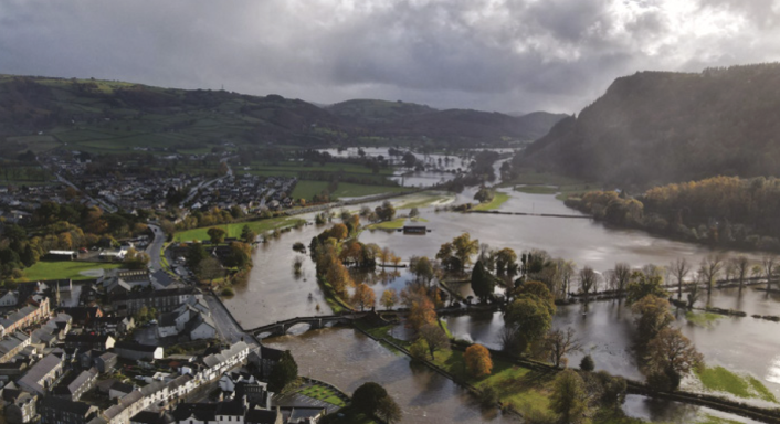
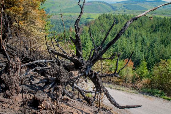
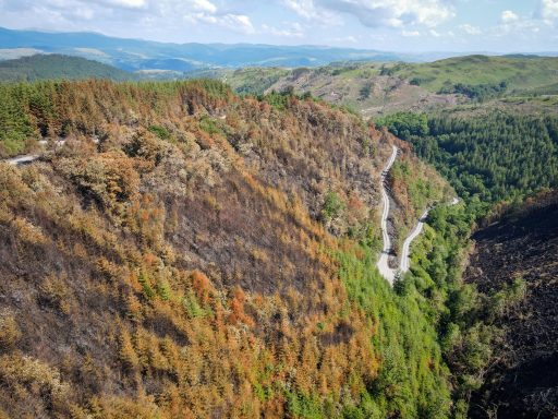
Drone aerial damage assessments provide rapid, detailed, and safe evaluations of damage to infrastructure, buildings, and landscapes after natural disasters or other catastrophic events. Drones capture high-resolution 2D and 3D imagery that is then processed using AI and computer vision to generate precise damage maps, helping insurers, disaster responders, and authorities with tasks like claim processing, infrastructure planning, and strategic resource deployment. This technology replaces dangerous and inefficient ground-based surveys, offering a fast, comprehensive, and cost-effective method for understanding and responding to emergencies.
How Drone Damage Assessments Work
- Data Acquisition: Drones equipped with high-resolution cameras and sensors capture detailed aerial images and video of affected areas
- Data Processing: This raw data is processed to create orthomosaic maps (stitched-together 2D images), 3D models, point clouds, and digital elevation maps
- Damage Analysis: AI and machine learning algorithms analyze the processed data to identify and quantify damage, assess its extent and location, and detect changes from previous surveys.
- Reporting and Action: The extracted information is delivered to a platform where it can be used for various purposes, including calculating damage extent for insurance, identifying areas needing urgent rescue efforts, or planning long-term recovery strategies.
Key Benefits
- Speed and Efficiency: Drones provide immediate, on-demand information, significantly reducing the time it takes to assess large-scale damage compared to traditional methods.
- Safety: Assessments are conducted from a safe distance, protecting human inspectors from hazardous conditions in disaster zones.
- Comprehensive Data: Drones offer high-resolution images and 3D models that provide a detailed and precise overview of damage, including structural changes not visible from the ground.
- Cost-Effectiveness: While there's an initial investment, drones can save money in the long run by making the assessment process more efficient and reducing risks associated with manual inspections.
- Improved Decision-Making: Accurate and timely data supports more informed and strategic planning for emergency response, resource allocation, and infrastructure management.
DAMAGE SURVEY
Whether landslips, wind, flooding or fire, we can quickly survey extensive hard to reach areas effectively, supporting your capacity to survey and inspect damage allowing resources to be targeted to contain, assess and repair


